Integrated subsurface information
Seismic, well, production, multi-physics and geomechanical information are brought together to develop a more complete understanding of the subsurface.
A subsurface intelligence and exploration mission built around an integrated understanding of seismic, well, production, multi-physics and geomechanical information.
Bhū-Anveshan is a subsurface intelligence and exploration mission built around the progression from 3D to 10D subsurface intelligence. It integrates seismic, well, production, multi-physics and geomechanical information to build a more integrated understanding of the subsurface.
Seismic, well, production, multi-physics and geomechanical information are brought together to develop a more complete understanding of the subsurface.
The framework advances toward AI, physics-based digital twins, integrated models, uncertainty analysis and predictive analytics.
The programme's data foundation brings together regional seismic coverage, volumetric seismic data, well information and offshore basin data.
Extensive national seismic coverage.
RegionalLarge-scale subsurface imaging.
VolumetricExploration and well information.
NationwideStrategic seismic coverage across offshore basins.
OffshoreSix objectives define the programme's focus, from national prospectivity mapping and subsurface understanding to risk assessment and decision support.
Discover prospective areas through national prospectivity mapping.
Understand how the subsurface changes through dynamic models.
Improve imaging and resolution through offset, azimuth, frequency and spectral intelligence.
Validate and cross-check interpretations using wells and multi-physics data.
De-risk exploration through geomechanical and drilling risk models.
Decide using AI, physics, uncertainty analysis and digital-twin capabilities.
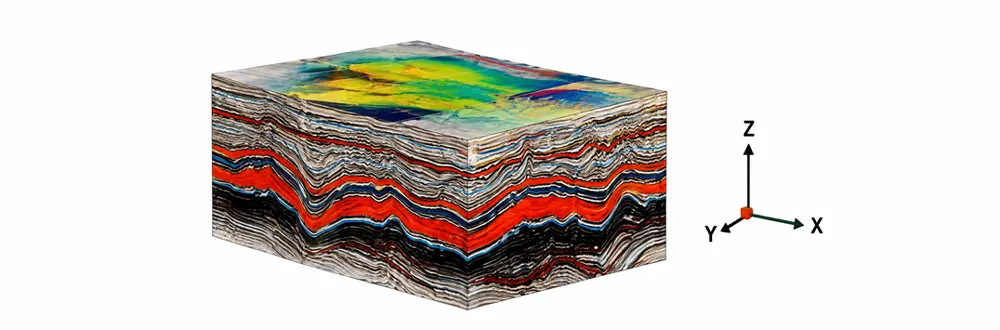
Select each dimension to explore its role, output and the uncertainty it addresses.
Build regional 3D subsurface models by interpreting seismic horizons, faults, structures and prospective areas to establish a clearer structural framework.
The programme integrates seismic, well, production, multi-physics and geomechanical information to build a more integrated understanding of the subsurface.
The programme identifies five areas where 10D intelligence can support exploration and investment decisions.
Quantify and reduce exploration risk.
Better targets and stronger confidence.
Data-driven decisions for higher returns.
Improve well success and cost efficiency.
Prioritize surveys with maximum impact.
Sovereign. Scientific. Strategic.