2D to 3D Conversion for Onshore Basin
Transforming scattered 2D seismic lines into structured pseudo-3D volumes for clearer subsurface interpretation and early-stage exploration decisions.
Explore the use case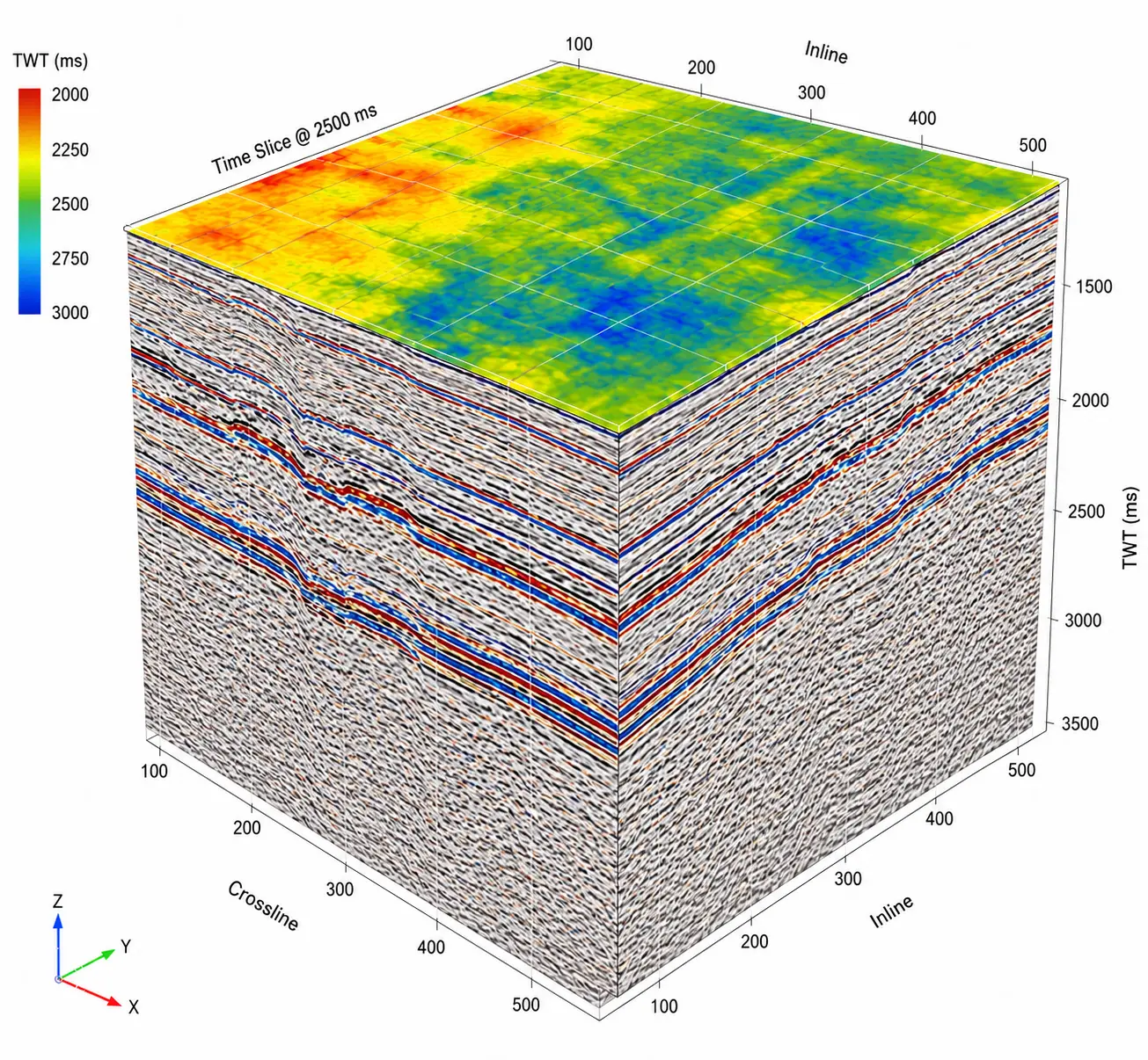
Scattered 2D seismic lines limit the view of the subsurface.
Several onshore basins still rely on 2D seismic data. Limited spatial continuity and the absence of volumetric coherence restrict structural mapping, stratigraphic analysis and early asset evaluation.
Limited Continuity
Difficulty interpreting structures, faults and stratigraphy consistently across regions.
Spatial Gaps
Non-uniform line spacing and missing lateral information between profiles.
Restricted Workflows
2D lines cannot directly support volumetric attribute analysis and advanced interpretation.
Evaluation Risk
Limited 3D coverage constrains early-stage exploration screening and asset valuation.
AI-enabled conversion from 2D lines to pseudo-3D volumes.
The SeisSense™ workflow combines geodetic gridding and velocity modelling to align sparse 2D seismic data and generate coherent pseudo-3D volumes for interpretation and attribute analysis.
Midpoint-Based Gridding
Align scattered 2D seismic lines into a consistent spatial grid using interpolation and geodetic corrections.
Velocity Modelling
Apply regression-based curve fitting to check-shot and well-tie data to derive continuous velocity fields across the basin.
Pseudo-3D Cube Generation
Generate volumes compatible with Petrel and OpendTect for attribute workflows and structural mapping.
Format Conversion & Delivery
Prepare 3D SEG-Y volumes, navigation files and QC diagnostics for downstream use.
From scattered 2D seismic lines to interpretation-ready pseudo-3D volumes.
The workflow was applied to more than 1,000 km of 2D seismic data, combining seismic lines and well data to generate coherent pseudo-3D outputs.
Input Data
More than 1,000 km of 2D SEG-Y seismic lines and well log data from multiple field blocks.
Processing Scope
Spatial gridding, interpolation, denoising, velocity modelling and 3D format conversion.
Final Output
Coherent pseudo-3D SEG-Y cubes, matching navigation files and QC plots for downstream interpretation.
Coherent Pseudo-3D Seismic Cube
A structured volume for volumetric interpretation, attribute workflows and structural mapping.
Pseudo-3D conversion workflow at a glance.
2D Seismic & Well Data
Ingest 2D SEG-Y lines and supporting well log data from multiple field blocks.
Gridding & Velocity Modelling
Align seismic lines through spatial gridding and interpolation, then derive continuous velocity fields.
Pseudo-3D Output
Generate coherent 3D SEG-Y volumes with navigation files and QC diagnostics for interpretation.
Delivered through SeisSense™, combining spatial gridding, velocity modelling and pseudo-3D volume generation in an integrated seismic processing workflow.
Unlocking more value from existing seismic data.
The workflow improves subsurface visibility and supports exploration decisions without immediately requiring new 3D seismic acquisition.
Improved Subsurface Visualization
Enabled early-stage reservoir screening and structural understanding across underexplored regions.
Reduced Acquisition CAPEX
Lowered the need for immediate 3D seismic acquisition, reducing associated capital costs.
Faster Bidding & Evaluation
Delivered pseudo-volumes supporting lease bidding, volumetric estimates and exploration prioritization.
Extended Value of Legacy Data
Revived historical 2D datasets for modern workflows, improving return on previously acquired data.
The 40% acquisition CAPEX reduction is the reported result stated in the source use case. Other benefits are described qualitatively.
SeisSense™
AI-powered seismic processing and subsurface intelligence for exploration and interpretation workflows.
Have a subsurface challenge to solve?
Let's explore how AI can support your seismic workflows.
Discuss this use case